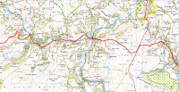
We are both delighted to have managed to complete the Coast to Coast and raise some money for the Roy Castle Lung Cancer Foundation. We would like to thank everyone for tuning into our blog and supporting us both every step of the way. This support has been invaluable in helping us through the difficult stages we encountered.
We would like to say a special thank you to the following people:
. Sue (wife/mother) and Mary (mother-in-law/grandmother) for being our support crew during the walk.
. All friends and family of Barry and Michael who have provided sponsorship.
. Everyone from the Fire Safety Engineering Group (FSEG) at the University of Greenwich for their support and sponsorship.
. Everyone from Lloyds TSB Commercial Finance for supporting and sponsoring us and the guys in the IT department who loaned us the kit to allow us to produce our blog.
. Everyone at Emmanuel Church in Greenwich who sponsored us.
. Mary, the proprietor of the Postgate Farm B&B (where we stayed in Glaisdale) who was a complete stranger when we first met her, but who sponsored us immediately without even being asked.
. Clare Trevorrow from the Roy Castle Lung Cancer Foundation for providing help and support along the way.
In addition, we would like to give a brief mention to some of the B&B owners on our Coast to Coast which went that extra mile during our very short stays:
. Stonethwaite; Knotts View: lovely B&B, very accommodating and helpful.
. Patterdale; Grisedale lodge: Really friendly owners, carried our bags to our rooms, dried our boots, provided tea and cake on arrival, give advice for the walk, very high quality B&B.
. Glaisdale; Mary (Postgate Farm) & Sandra (The Red House). First rate B&B, very reasonably priced, excellent accommodation.
We did this walk in memory of Rob Disspain, Barry's brother in-law and Michael's Uncle, who despite succumbing to lung cancer in 2009, managed to live such a full life. Though he is gone, he is very much in our thoughts.
Saturday, May 29, 2010
Friday, May 28, 2010
Day 12:Glaisdale to Robin Hood's Bay, 19 miles (30.5km)
So, the last day of our marathon walk has finally arrived. Nineteen miles left until we would be splashing around in the North Sea at Robin Hoods Bay.
The day started with Breakfast at 08:00AM, fairly late for us, but on the last day we both felt we deserved a bit of a lie in. Having devoured the excellent breakfasts on offer at "The Red House" and "Postgate Farm" (one of us stayed at The Red House and the other at Postgate Farm - we didn't eat two breakfasts each), we commenced the days walking at 09:15AM. The weather, as usual, was perfect for walking and the route was quite friendly at first. However, this was to change when we reached Grosmont where we encountered a massive hill, gradient was 30% for most of it and it went on and on ...... and on and on. Well over a mile of it.
After that, everything was fairly straightforward, walking mainly across moorland, quite boggy, but not too bad.
The final section of the walk involved fairly easy clifftop walks around the Robin Hoods Bay area, culminating in a steep descent into the charming little village of Robin Hoods Bay, where we wasted no time in completing our mandatory "paddle" in the North Sea, then obtaining a pint from the conveniently located Bay Hotel.
So, we've done it. No walking at all tomorrow. At the end of it all, Michael still seemed fit enough to commence the return trip back to St Bees. Barry?, well, maybe not quite so fit.
That's just about it for the blogs now, apart from one final posting tomorrow, where we'll attempt to thank everybody who has been so kind to us during the walk, and we'll be mentioning various B&B's we've stayed in where we've received exceptional service, courtesy and value for money.
Before setting off on the final day ....
A pleasant riverside view
A moorland element of todays walk, with a welcome view of the sea in the background.
Don't jump Michael ..... Michael on the cliffs about a mile out of Robin Hoods Bay.
Our destination, Robin Hoods Bay - about 1/2 mile away.
Finished .... The final ritual, paddling in the sea at Robin Hoods Bay
A group photograph - James, Barry, Michael, Jim, Ian - all coast to coasters, together with Jim's children.
Michael's iPhone/GPS zoomed out screenshot of our final location (admittedly taken the following morning :P)
ROUTE:
PROFILE:
Thursday, May 27, 2010
Day 11:Clay Bank Top to Glaisdale, 20 miles (32km)
Day 11 started at 7:30AM prompt, with an early departure from Clay Bank Top (Chop Gate, actually, we still needed to walk another mile or so to get to Clay Bank Top). The weather was again kind, bright and cool, following a good deal of rain overnight.
The walk itself was very long and tedious. Not a great deal to look at, and the quality of many of the paths were very poor indeed. A long morning session was punctuated by a short break at the Lion Inn at Blakely Ridge, followed by yet another long tedious afternoon session.
We finally arrived at our destinations in Glaisdale at around 3:15PM. (Due to circumstances beyond our control, we are staying at different B&Bs tonight - but what a result! Both B&Bs offer en-suite bathrooms with BATHS. What a luxury).
It's the last day of the walk tomorrow. Another 19 miles from Glaisdale to Robin Hoods Bay.
A welcome sight, Lunch approaches (The Lion Inn at Blakely Ridge)
Noooooooo!!..... Not another fryup
Only six more miles to go .....
ROUTE:
PROFILE:
Wednesday, May 26, 2010
Day 10:Ingleby Cross to Clay Bank Top, 12.5 miles (20km)
This morning we set off (around 8:45AM) in high spirits as we knew that we only had a relatively short distance to cover and this was the first time we would be walking in the Yorkshire Dales. Luckily our feet had mostly recovered from yesterday's 'fun' and we were looking forward to a leisurely walk. Whilst the route included some mild ascents/descents, for the most part this was a reasonably enjoyable day with some nice views.
View from the Cleveland Way
A little rain around midday made the already cooling breeze a bit cold and both of us donned our waterproof jackets for a short time. The rain didn't last long and we arrived at Beak Hill farm (a small farm about 1km from the main trail) at around 2:20PM to a roaring log fire.....and no phone reception with O2 or Orange! We were however, pleasantly surprised to find that the Vodafone 3G dongle that we use for the laptop to connect to the Internet could pick up a signal.
Barry 'loves' hill walking
Michael's handy Hazmat suit for biological attacks
ROUTE:
PROFILE:
Tuesday, May 25, 2010
Day 9:Richmond to Ingleby Cross, 23 miles (37km)
So, today was the 23 miler we've been dreading ever since we started the coast-to-coast walk. We left our superb guesthouse in Richmond at 7:15AM after a massive Breakfast (Full English, again).
The weather was very kind again, slight drizzle and overcast, so we were never likely to get burnt to a cinder today. The walk itself was pretty boring and uneventful, really. Nothing really spectacular to look at, just 23 miles of rather tedious plodding. Looking on the bright side, this just spurred us on to increase our pace and get the walk finished. We arrived at our new lodgings around 3:40PM - much earlier than we'd expected.
Tomorrow is a much friendlier day, just 12.5 miles or so. So, assuming our calf muscles have recovered, we are expecting a fairly comfortable walk.
Richmond Castle
Barry exits the Jungle
Michael in motion
ROUTE:
PROFILE:
Monday, May 24, 2010
Day 8:Reeth to Richmond, 11 miles (17.5km)
A civilized breakfast at 8:00AM allowed us to leave our comfortable lodgings in Reeth at just before 9:00AM for the 11 mile walk to Richmond (Yorkshire, not London). The weather today was much kinder - still sunny, but with a gentle cool breeze for the duration of the walk. The walk itself was very pleasant, passing through acres of farmland before eventually arriving on a hill high above Richmond. A leisurely descent saw us reach our destination lodgings at about 12:45PM, long before our "support team" had arrived and before our very hospitable landlady had managed to prepare our rooms. We reassured her that there was no hurry, dumped our kit, and adjourned to the adjacent Wetherspoons pub to contemplate the days walk with a couple of fellow "Coast-to-Coasters".
Tomorrow is a big day, 23 miles to cover. We can't leave our lodgings until after we've eaten the mandatory "Full English Breakfast", so we'll be starting at about 8:00AM. Hopefully the weather will be kind again. Dry with a light breeze will do nicely.
Michael at a crossroads - Luckily the Coast-to-Coast sign gives an idea of the correct direction.
A scene on the route between Reeth and Richmond.
Our destination for today, Richmond, about 1.5 miles out.
Barry taking a breather with some fellow "Coast-to-Coasters" close to Richmond.
ROUTE:
PROFILE:
Sunday, May 23, 2010
Day 7:Keld to Reeth, 11 miles (17.5km)
Another cloudless sky and therefore extremely hot morning saw us leave the Keld Lodge hotel at around 8:45AM. (The Keld Lodge is highly recommended, by the way - perhaps a little more expensive than some, but in our opinion very worthwhile).
The route was initially very picturesque, taking the low route from Keld to Reeth alongside the river with quite a bit of shade. Unfortunately, this shade disappeared about half way through, and we had to content with the scorching sun for the remaining five miles or so.
We arrived at our destination in Reeth a little before 3:00PM, very hot, and in severe need of yet another recuperative visit to the local pub.
In the picture above, Michael finds a mode of transport best suited to his driving abilities.
A typical vista on the route from Keld to Reeth.
Barry is relieved that he lost so much weight recently, as all the stiles and gateways around here seem to have been designed for hobbits
ROUTE:
PROFILE:
Subscribe to:
Posts (Atom)