Saturday, May 22, 2010

Day 6:Kirkby Stephen to Keld, 13 miles (21km)

Completing today’s walk has meant we are half way through the Coast to Coast, having hiked a total distance of around 95 miles over the past 6 days. Last night we stayed in Kirkby Stephen Youth Hostel, in a converted church, which we can't say we were particularly looking forward to (nothing to do with the church but YHAs can be a bit hit and miss). We were pleasantly surprised to find it to be reasonable and very good value for money.

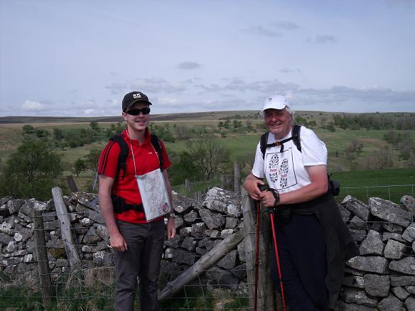
Before we started today we were a little apprehensive as the route, though not being very long in distance, included the second highest peak on the entire Coast to Coast called Nine Standards Rig (662m). However, after setting off at around 8:45AM, we were pleasantly surprised to find that the ascent was very gradual and didn’t appear to last too long. Just next to the top of the 'hill', were nine slate towers/cairns varying in height between about 8-12 foot (hence the name). We briefly stopped here to make use of the shade they provided and as we did, Jim and James came along (the Kent lads we had previously travelled with). After sharing a few tales from the night before in Kirkby Stephen with them, we moved on from the towers/cairns to begin our descent into Keld, our destination.


We arrived into Keld at around 2:45PM. The weather was very hot with unbroken sunshine which made hiking a lot more strenuous. All in all today’s hike wasn't too much of a challenge compared to other days throughout this week but the increasing fatigue and strain on our feet is beginning to show; both of us now have blisters (Barry's feet could literally be stunt doubles for John Merrick's!).


Luckily tonight’s accommodation is a little more upmarket than all of our previous accommodation which has meant we can relax a little more. Tomorrow’s hike is a short one and fairly flat so fingers crossed it won't take too long.


We would like to invite anyone reading our blog to leave comments at the bottom (words of wisdom, encouragement or abuse are all welcome!...preferably not the later though).


ROUTE:


PROFILE:

Friday, May 21, 2010

Day 5:Shap to Kirkby Stephen, 20 miles (32km)

Well, todays twenty miler showed plenty of promise for being the most exhausting day so far. Certainly it wasn't much easier than yesterdays epic.

We left Shap at around 9:00AM after a very good breakfast. The walk was generally quite flat apart from a couple of hilly bits (conveniently located towards the end of the hike, when we were most tired).


We left the Lake District fairly early in the trek, crossing the beautiful M6 motorway (A major blot on the landscape).


We soon met up with a couple of Coast-to-Coasters from Derby / Leicester. Cathy and Dianna kept us company for the remainder of the days walk, sharing navigation and providing mutual encouragement.


We finally arrived at Kirkby Stephen at around 6:45pm, absolutely shattered!!.
Time for a quick shower and off to the pub to recuperate.


ROUTE:


PROFILE:

Thursday, May 20, 2010

Day 4:Patterdale to Shap, 16 miles (25.5km)

After a relatively late leisurely breakfast (8:30am) we embarked on day four of our coast-to-coast trek, anticipating another very hard slog including the highest climb of the entire route (Kidsty Pike at 2560ft). Needless to say, we were not disappointed. The climb to Kidsty Pike wasn't too bad (views were spectacular here), neither was the descent to Haweswater Reservoir (It looked good at first, but after slogging around it for an hour or so, it got a bit boring). However, the walk around the reservoir and the seemingly endless miles along country "paths", was totally exhausting.


We finally arrived at our destination in the small village of Shap (never was the sight of a B&B more welcome), at around 6:15pm, a total of 9 hours 15 minutes walking, with not too many breaks in between.


Tomorrow, we have a TWENTY MILE walk across reasonably flat countryside to look forward to. We also bid farewell to the Lake District. (Beautiful countryside, but walks are very hard work - for "less than super-fit" persons like us).


ROUTE:


PROFILE:

Wednesday, May 19, 2010

Day 3:Rosthwaite to Patterdale, 17.5 miles (28km)

As we expected today's walk to be quite tough we decided to have an early start at 7:20AM (we must thank Mrs Jackson of Knotts View B&B for accommodating our request for such an early breakfast...if you are ever in the area this is a B&B well worth considering!).

After a steep initial climb we were presented with Lining Crag which required us to use our hands to climb as the footholds were totally unreliable. At the top somebody had left a full bottle of Vodka and an old digital watch - presumably someone trying to make a statement - "It's never a good time to drink a bottle of vodka on a mountain"?


On the top of the mountain there was thick fog; a bit like an 80s disco. Coupled with the fact that there were no obvious paths made navigation very difficult. Thank God for having a GPS app on the iPhone! Along the way we met a couple of Kent lads; Jim and James. Considering the poor conditions we decided to stick together. Also Jim and James had heard of a 'shortcut' which would save us 3 miles (a more than welcome offer!). The shortcut led to a very steep descent which meant we had to 'ass-slide' down the side of the mountain holding onto a fence in to the Grassmere valley. Ascent & Descent one complete. Now we had to do the second one!


The second ascent was much more gentle and a convenient stream was available for us to follow, meaning navigating was much easier. In addition the mist had lifted somewhat on the second mountain and the paths were much more clearly defined which also helped things a little. We arrived at our accomodation, Grinsdale Lodge at around 5:30PM to be welcomed by a very nice couple who took our bags up to our rooms and also offered to put newspaper in our boots to help dry them out...now thats what we call service!


We have gained some confidence in hiking/navigating today and are a bit more upbeat about tomorrow which includes the highest part of the Coast to Coast - Kidsty Pike (739m high).


Happy to find Patterdale has Vodafone 3G reception :)

ROUTE:


PROFILE:

Tuesday, May 18, 2010

Day 2:Ennerdale to Roshthwaite, 14.5 miles (23km)

After spending a restless night at Low Cock How B&B, and having the obligatory 'full English' for breakfast, we set off at around 8:15AM. Today's walk included our first major ascent (600m+) and coupled with the brilliant weather meant we were treated to some amazing views of the Lake District (not to mention still being able to see the sea, which was a bit disappointing).


We met a number of other Coast to Coasters on the trail today and it was quite interesting hearing other people's experiences.

The walk today was quite tiring. Barry's socks were literally 'bloody' due to blisters and Michael's feet were rubbing a little after the walk. In addition, both of us got sunburnt (beaming sunshine and cooling mountain breezes are a painful combination).


We arrived at our accommodation, a quaint B&B in a 450 year old building at around 4:45PM this afternoon. It is located in the village of Stonethwaite in a narrow valley; alas, there is no 3G or mobile phone reception (this blog is being updated from a chippy up the road in Keswick).

Tomorrow's walk will be tougher with 2 peaks over 600m and a longer distance to cover; we are going to need to dig deep.

ROUTE:


PROFILE:

Monday, May 17, 2010

Day 1:St Bees to Ennerdale, 14 miles (22.5km)

We spent our first night at Stonehouse Farm B&B in St Bees which was really very good; they provided a fairly substantial packed lunch. We departed at around 8.30am this morning following a full English Breakfast and strolled down to St Bees Beach where tradition dictates that one pebble should be collected and deposited at Robin Hood's Bay at the other coast(just to confuse Geologists!).


Michael's iPhone/GPS zoomed out screenshot somewhere between St Bees and Ennerdale

We also dipped our boots in the Irish Sea (so we can truly say we have walked Coast to Coast).


We met a few other Coast to Coasters along the way and there was some really nice scenary (with sunshine all day). Climbing Dent Fell (our first proper climb) was a little tiring (for Michael) and considerably more tiring from Barry. The descent was quite steep and Barry wished he had taken the trouble to buy some ski's to accompany his sticks!


We arrived at Low Cock How Farm (our current nights accomodation) near Ennerdale Bridge where we were surprised once more to discover that we had 3G coverage! (still within the reaches of civilisation!).


No blisters so far and we are looking forward to the entering the main Lake District area tomorrow.

ROUTE:


PROFILE:

Sunday, May 16, 2010

The Day Before...

Following a very pleasant journey by car up to The Lake District we've finally arrived at St Bees and got some foods in one of the local pubs, The Queens Head. Our ETB accommodation, Stone House Farm is superb and lives up to all of our expections.


We were most surpised to find that we have 3G coverage from our B&B, albeit very temperamental.


Both of us are really looking forward to starting the walk tomorrow and hope the weather holds up.